Carlo Schmidt · 10 September 2026
How Tidal Patterns Influence Plant Distribution in Coastal Meadow Zones
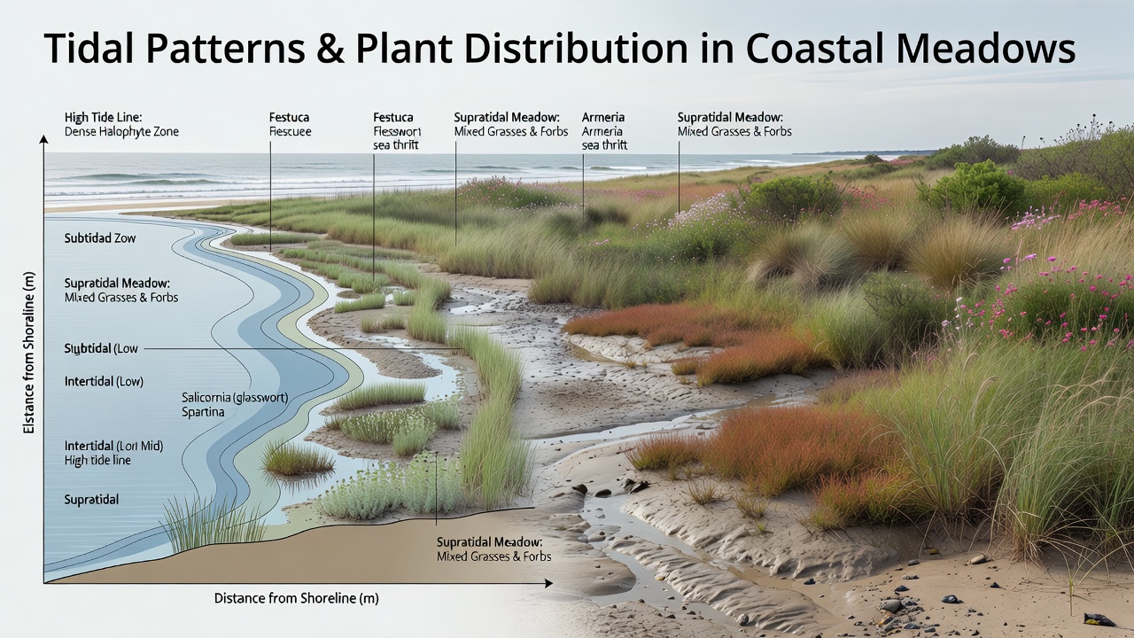
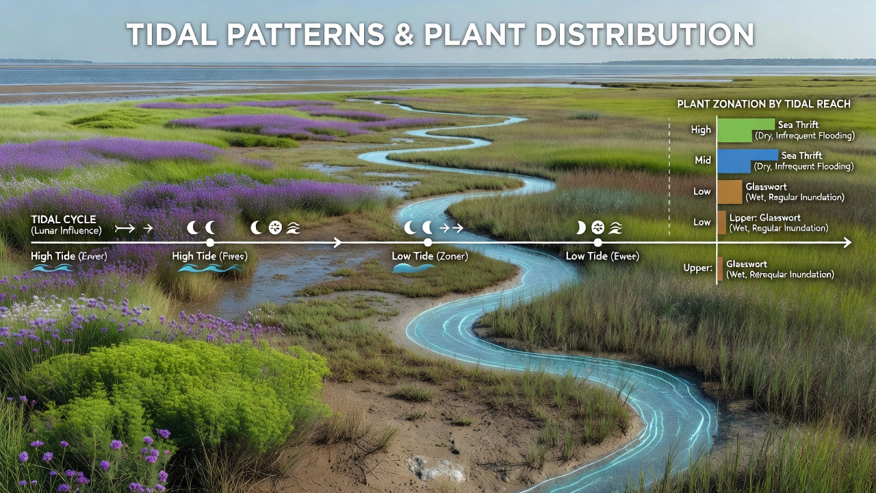
Coastal meadow zones sit at the edge where land meets sea and tidal patterns dictate which plants survive in each strip of ground, because regular flooding brings salt water that changes soil chemistry while exposing roots to varying oxygen levels. Researchers track these movements through long-term monitoring stations that record water height, salinity spikes, and sediment shifts, revealing clear bands of vegetation that align with how often and how deeply each area floods during spring and neap cycles. Data from multiple continents show that higher marsh areas experience shorter inundation periods, allowing salt-tolerant grasses to dominate lower zones while less tolerant herbs occupy slightly elevated ground farther inland.
Tidal Cycles and Soil Conditions
Tides create predictable rhythms that alter moisture and salt content in meadow soils, and experts measure these changes daily to map how sodium levels rise after high tides and drop during neap periods when freshwater seepage dilutes the surface. Studies in temperate regions indicate that clay-rich sediments hold salt longer than sandy ones, producing sharper plant boundaries where different species compete for space based on their tolerance thresholds. In September 2026, updated models from North American monitoring networks projected increased tidal amplitude in several bays due to sea-level trends, prompting renewed surveys of meadow transects to record any shifts in species placement before the next decade.
Plant Adaptations Across Elevation Gradients
Species such as Spartina and Juncus develop specialized root systems and leaf structures that manage salt exclusion or excretion, allowing them to occupy lower elevations where daily flooding occurs, whereas higher zones support more diverse forbs that cannot withstand prolonged submersion. Observers note that these adaptations appear consistently across sites because tidal energy sorts particles and nutrients into distinct layers that favor particular growth forms. Field teams in Australian coastal reserves have documented similar zonation patterns using elevation surveys combined with salinity probes, confirming that plant distribution follows the same tidal logic even under different climate regimes.
But here's the thing: when tidal patterns shift due to channel modifications or storm frequency, entire bands of vegetation can migrate upslope within a few seasons, as seeds disperse into newly suitable ground while older stands decline from increased stress. Research indicates that sediment accretion rates often keep pace with moderate sea-level rise in healthy meadows, maintaining elevation relative to mean high water, yet accelerated erosion in some areas leaves plants stranded below their optimal flooding tolerance. According to findings released by the European Environment Agency, long-term records from Baltic and North Sea sites reveal measurable inland movement of salt-marsh communities over the past thirty years.
Regional Case Examples and Monitoring Efforts
Take one estuary along the Pacific coast of Canada where researchers mapped plant cover against tide-gauge data and found that areas flooded more than 200 times per year supported only a handful of halophytes, while sites flooded fewer than 50 times hosted mixed communities including several grasses and sedges. Similar work in New Zealand estuaries shows that neap-tide exposure windows allow oxygen to reach deeper soil layers, enabling deeper-rooted species to establish and stabilize the meadow surface against wave action. These patterns emerge because tidal amplitude and timing interact with local topography to create microhabitats that sort species by physiological limits rather than random chance.
What's interesting is how sediment delivery during spring tides can build new elevation platforms that plants then colonize, turning what was open mudflat into meadow within a decade when currents slow enough for deposition. Data from multiple long-term plots demonstrate that nutrient pulses tied to tidal exchange further influence which plants gain advantage, with nitrogen-rich water favoring faster-growing species in mid-elevation bands. Government agencies in Australia and the United States maintain parallel monitoring programs that feed into shared databases, allowing comparisons across hemispheres to isolate tidal effects from other variables such as temperature or herbivory.
Future Projections and Management Implications
Models that incorporate both tidal harmonics and projected sea-level scenarios forecast continued upslope migration of meadow boundaries in many regions, and managers use these outputs to guide restoration plantings that match expected future conditions rather than historical ones. Evidence suggests that preserving natural sediment sources and avoiding hard structures that block landward movement gives meadows the best chance to adjust without losing overall area. International research collaborations continue to refine these predictions by integrating real-time sensor networks with satellite imagery that tracks vegetation greenness changes linked to inundation frequency.
Conclusion
Tidal patterns shape coastal meadow plant distribution through repeated cycles of flooding, salinity change, and sediment movement that create predictable elevation-based zones, and ongoing data collection confirms these relationships hold across widely separated geographic areas. As monitoring programs expand and models improve, the connections between tide timing and vegetation response become clearer, supporting decisions that maintain the dynamic balance these ecosystems require.